«Missouri River • Great Plains • Rocky Mountains» | «Radio • Writs • Ride • Resources»
Poison Ivy at Ft. Leavenworth.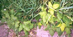
06/12/2001: Ft. Leavenworth, KS |
Too Tired |
«Missouri River • Great Plains • Rocky Mountains» | «Radio • Writs • Ride • Resources»
©2001 Barrett Golding / Josef Verbanac
![]() Funding from the Corporation for Public Broadcasting
Funding from the Corporation for Public Broadcasting